To view meetings live on a computer, visit cityofirvine.org/ictv (Open in new window) and select "Watch ICTV Live".
Cox Communications - Channel 30
AT&T U-Verse - Channel 99
To view meetings live on a computer, visit cityofirvine.org/ictv (Open in new window) and select "Watch ICTV Live".
Cox Communications - Channel 30
AT&T U-Verse - Channel 99
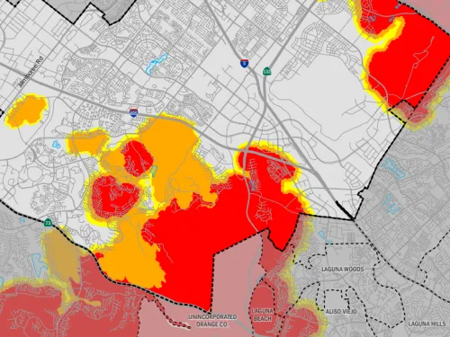
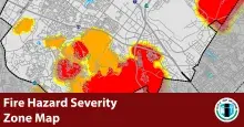
The California Office of the State Fire Marshal has released its 2025 Fire Hazard Severity Zone maps for the state of California, including Irvine. These maps use the latest climate data, fire history, topography, and wildfire modeling to classify areas as Moderate, High, or Very High fire hazard zones.
The City of Irvine is required by law to adopt the map within 120 days after it is released by the State. It is also required to make the map available to the public and collect community input before it is adopted.
Celebrate the Fourth of July at the Great Park!
Join us as we kick off a new Fourth of July tradition at the Great Park Friday, July 4, from 4 to 10 p.m. Celebrate, connect with your community, and create lasting memories at this unforgettable Independence Day event filled with fun, music, and a spectacular grand finale.
To sign up for updates or to access your subscriber preferences, please enter your contact information.